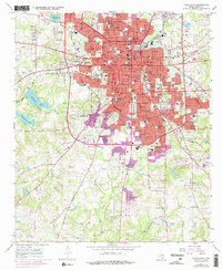
1966 Map of Tyler South
USGS Topo · Published 1976About this map
Tyler's mid-century expansion is clearly documented here, showing the city's growth southward toward the Troup Highway during a period of significant urban development. The presence of Texas College, Butler College, and Tyler Jr College underscores the city's role as a regional educational hub, while the famed Tyler Rose Park and Caldwell Zoo highlight its cultural infrastructure. The landscape is defined by its social history, with several legacy burial grounds such as Oakwood Cem and West View Cem situated near the city center, and the Ahavath Achim Cem located further west. Beyond the urban grid, the terrain is carved by Indian Creek and Willow Creek, leading toward the substantial waters of Bellwood Lake. The map captures the industrial and transportation backbone of the era, from the hospital district featuring Mother Frances Hospital to the rail corridors of the Southwestern RR and Missouri Pacific.
Find a feature on this map
68 named features on this map. Tap any name to fly to it.
Don’t see what you’re looking for? This feature index may not catch every label — zoom into the map to look around manually.
Map Details
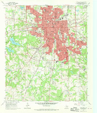
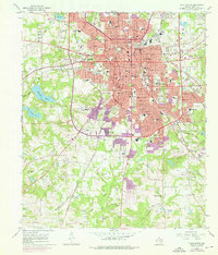
Editions of this 1966 Tyler South Map
Other maps of this area

1937 · Troupe
USGS Topo · 1:48,000

1938 · Winona
USGS Topo · 1:48,000

1943 · Troup
USGS Topo · 1:62,500

1943 · Winona
USGS Topo · 1:62,500

1946 · Bullard
USGS Topo · 1:62,500

1948 · Bullard
USGS Topo · 1:62,500

1948 · Tyler
USGS Topo · 1:62,500

1949 · Tyler
USGS Topo · 1:62,500

1956 · Tyler
USGS Topo · 1:250,000

1966 · Chandler
USGS Topo · 1:24,000