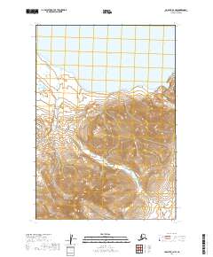
2019 Map of Ugashik B-3 NW
USGS Topo · Published 2019About this map
Lower Ugashik Lake dominates the northern reaches of this coastal Alaskan landscape, situated within the Lake and Peninsula Borough. The terrain transitions from the expansive waters of the lake into a series of smaller, isolated water bodies including Lenora Lake and Elizabeth Lake. This 2019 survey, produced by the U.S. Geological Survey, reflects the modern topography of the Alaska Peninsula, where sharp elevation changes and deep ridgelines define the interior. The absence of roads or permanent settlements in this specific quadrant emphasizes the wild character of the region, providing a clear record of the hydrologic network and natural contours as they exist in the early twenty-first century.
Find a feature on this map
7 named features on this map. Tap any name to fly to it.
Don’t see what you’re looking for? This feature index may not catch every label — zoom into the map to look around manually.
Map Details
Editions of this 2019 Ugashik B-3 NW Map
This is the sole edition of this map. No revisions or reprints were ever made.
Other maps of this area

1943 · Ugashik
USGS Topo · 1:250,000

1948 · Ugashik
USGS Topo · 1:250,000

1949 · Ugashik
USGS Topo · 1:250,000

1951 · Ugashik C-4
USGS Topo · 1:63,360

1951 · Ugashik B-3
USGS Topo · 1:63,360

1951 · Ugashik C-3
USGS Topo · 1:63,360

1954 · Ugashik B-4
USGS Topo · 1:63,360

1963 · Ugashik
USGS Topo · 1:250,000
2019 · Ugashik B-4 SE
USGS Topo · 1:25,000
2019 · Ugashik B-3 SW
USGS Topo · 1:25,000