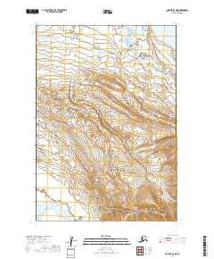
2019 Map of Ugashik B-4 NE
USGS Topo · Published 2019About this map
Lower Ugashik Lake sits in the northeastern corner of this coastal Alaska interior, representing a vital part of the Bristol Bay drainage system. The terrain is characterized by the meandering path of the Dog Salmon River in the southwestern quadrant, a waterway essential to regional ecology and indigenous subsistence patterns. This 2019 survey documents the wild landscape within the Lake and Peninsula Borough, where the absence of roads or permanent settlements highlights the isolation of the Alaska Peninsula. Surveyed boundaries for t31s r48w and t32s r49w provide the legal framework for this vast wetland and upland habitat, a crucial area for understanding the natural geography of the region before modern development or major infrastructure reached this section of the peninsula.
Find a feature on this map
6 named features on this map. Tap any name to fly to it.
Don’t see what you’re looking for? This feature index may not catch every label — zoom into the map to look around manually.
Map Details
Editions of this 2019 Ugashik B-4 NE Map
This is the sole edition of this map. No revisions or reprints were ever made.
Other maps of this area

1943 · Ugashik
USGS Topo · 1:250,000

1948 · Ugashik
USGS Topo · 1:250,000

1949 · Ugashik
USGS Topo · 1:250,000

1951 · Ugashik C-4
USGS Topo · 1:63,360

1951 · Ugashik B-3
USGS Topo · 1:63,360

1951 · Ugashik C-3
USGS Topo · 1:63,360

1954 · Ugashik B-4
USGS Topo · 1:63,360

1963 · Ugashik
USGS Topo · 1:250,000
2019 · Ugashik C-4 SW
USGS Topo · 1:25,000
2019 · Ugashik B-4 SE
USGS Topo · 1:25,000