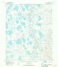
1955 Map of Umiat D-2
USGS Topo · Published 1970About this map
The Itkillik River dominates this portion of the North Slope, weaving a complex path of oxbows and meanders through a landscape saturated with unnamed lakes and ponds. This 1955 survey by the Army Map Service and the U.S. Geological Survey reveals a territory largely devoid of permanent human infrastructure, focusing instead on the intricate hydrography and varying elevations of the tundra. The river's winding course indicates a mature fluvial system cutting through a relatively flat Arctic plain, where seasonal drainage patterns are clearly defined by the numerous water bodies and marshy depressions. While no settlements are indicated, the map provides an exacting record of the natural topography and township boundaries, including the intersection of T. 8 N. and T. 7 N., before significant industrial shifts reached this part of the Alaskan interior.
Find a feature on this map
4 named features on this map. Tap any name to fly to it.
Don’t see what you’re looking for? This feature index may not catch every label — zoom into the map to look around manually.
Map Details
Editions of this 1955 Umiat D-2 Map
3 editions found
Other maps of this area

1951 · Harrison Bay
USGS Topo · 1:250,000

1952 · Umiat
USGS Topo · 1:250,000

1955 · Harrison Bay
USGS Topo · 1:250,000

1955 · Umiat D-2
USGS Topo · 1:63,360

1955 · Harrison Bay A-2
USGS Topo · 1:63,360

1955 · Harrison Bay A-3
USGS Topo · 1:63,360
1955 · Harrison Bay A-1
USGS Topo · 1:63,360

1955 · Umiat D-3
USGS Topo · 1:63,360
1955 · Umiat D-1
USGS Topo · 1:63,360

1955 · Umiat C-3
USGS Topo · 1:63,360