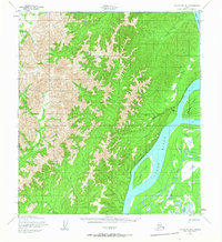
1952 Map of Unalakleet B-2
USGS Topo · Published 1965About this map
The Yukon River dominates the eastern edge of this interior landscape, carving a wide path past Alice Island and a complex network of seasonal waterways. This 1952 survey, which includes minor revisions from 1965, documents a period of transition in the Alaskan wilderness where river-based transport remained vital. The settlement of Blackburn (Aban'd) is already noted as abandoned by the early 1950s, serving as a reminder of the shifting nature of remote outposts during the territory's development.
Find a feature on this map
13 named features on this map. Tap any name to fly to it.
Don’t see what you’re looking for? This feature index may not catch every label — zoom into the map to look around manually.
Map Details
Editions of this 1952 Unalakleet B-2 Map
2 editions found
Other maps of this area

1951 · Unalakleet
USGS Topo · 1:250,000

1952 · Unalakleet A-2
USGS Topo · 1:63,360

1952 · Unalakleet A-3
USGS Topo · 1:63,360

1952 · Unalakleet C-2
USGS Topo · 1:63,360

1952 · Unalakleet A-1
USGS Topo · 1:63,360

1952 · Unalakleet C-3
USGS Topo · 1:63,360

1952 · Unalakleet B-3
USGS Topo · 1:63,360

1952 · Unalakleet C-1
USGS Topo · 1:63,360

1952 · Unalakleet B-2
USGS Topo · 1:63,360

1952 · Unalakleet B-1
USGS Topo · 1:63,360