
1950 Map of Unalakleet D-4
USGS Topo · Published 1958About this map
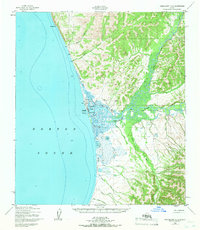
Unalakleet serves as the central hub of this coastal survey, situated where the Unalakleet River meets the Norton Sound. The map documents a critical intersection of traditional land use and mid-century infrastructure, featuring the Unalakleet Native Reservation alongside modern additions like an Airstrip, Radio Towers, and a Light. The landscape is defined by the complex water systems of the Tidal Flats and Kuyukutuk Slough, while a Winter Trail provides a terrestrial link across the rugged terrain toward Blueberry Pt.
Find a feature on this map
25 named features on this map. Tap any name to fly to it.
Don’t see what you’re looking for? This feature index may not catch every label — zoom into the map to look around manually.
Map Details
Editions of this 1950 Unalakleet D-4 Map
2 editions found
Other maps of this area

1948 · Norton Bay
USGS Topo · 1:250,000

1950 · Unalakleet D-3
USGS Topo · 1:63,360

1950 · Norton Bay A-4
USGS Topo · 1:63,360

1950 · Norton Bay A-3
USGS Topo · 1:63,360

1951 · Unalakleet
USGS Topo · 1:250,000

1951 · Norton Bay
USGS Topo · 1:250,000

1952 · Unalakleet C-3
USGS Topo · 1:63,360

1952 · Unalakleet C-4
USGS Topo · 1:63,360
1952 · Unalakleet C-5
USGS Topo · 1:63,360

1952 · Unalakleet
USGS Topo · 1:250,000