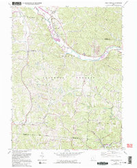
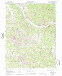
1961 Map of Union Furnace
USGS Topo · Published 1995About this map
Hocking River valley settlements define this portion of the northern Appalachian plateau, where industrial and agricultural patterns meet. The settlement of Haydenville stands out as a company town known for its unique architectural heritage, while Union Furnace reflects the region's early iron production history. The landscape is heavily marked by the extractive industries of the mid-20th century, with numerous instances of Strip Mine activity cutting through the terrain between Zion Ridge and Asbury Ridge. Much of the land is preserved within the Wayne National Forest and Zaleski State Forest, creating a mosaic of public timberland and private holdings. Local genealogy is well-represented through family and community burial sites like Wolf Cem, Morse Lewis Cem, and the Groves Cem. The Chessy System railroad corridor and an Old Railroad Grade illustrate the transport networks that once linked these hollows to the broader Hocking Valley economy.
Find a feature on this map
47 named features on this map. Tap any name to fly to it.
Don’t see what you’re looking for? This feature index may not catch every label — zoom into the map to look around manually.
Map Details
Editions of this 1961 Union Furnace Map
6 editions found
Other maps of this area

1903 · Athens
USGS Topo · 1:62,500

1904 · Zaleski
USGS Topo · 1:62,500

1905 · Athens
USGS Topo · 1:62,500

1907 · Zaleski
USGS Topo · 1:62,500

1907 · Logan
USGS Topo · 1:62,500

1909 · Logan
USGS Topo · 1:62,500

1911 · New Lexington
USGS Topo · 1:62,500

1947 · Columbus
USGS Topo · 1:250,000

1961 · Columbus
USGS Topo · 1:250,000

1961 · Nelsonville
USGS Topo · 1:24,000