Loading...
Loading map...2023 Map of Upper Sandusky
USGS Topo · Published 2023About this map
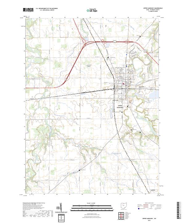
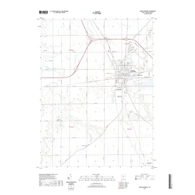
Upper Sandusky serves as the focal point of this Wyandot County survey, where the historic Wyandot County Courthouse stands at the center of a dense municipal grid. The town is deeply rooted in its local heritage, evidenced by the high concentration of burial grounds such as the Old Mission Cem and Fort Ferree Cem. To the east, the Sandusky River winds through the landscape, flanked by the Upper Sandusky Reservoir and the small community of Mononcue.
Find a feature on this map
91 named features on this map. Tap any name to fly to it.
Don’t see what you’re looking for? This feature index may not catch every label — zoom into the map to look around manually.
Map Details
Date Portrayed2023
Date Published2023
PublisherU.S. Geological Survey
Map TypeTopographic
Scale1:24,000
Physical Dimensions24 x 29 inches
Editions of this 2023 Upper Sandusky Map
This is the sole edition of this map. No revisions or reprints were ever made.
Historical Maps of Upper Sandusky Through Time
7 maps found


Featured Locations
- Upper Sandusky, OH
- Crane Township, OH
- Pitt Township, OH
- Harpster, Pitt Township
- Mononcue, Upper Sandusky
Source Details
SourceU.S. Geological Survey
CopyrightPublic Domain