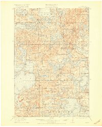
1915 Map of Vergas
USGS Topo · Published 1920About this map
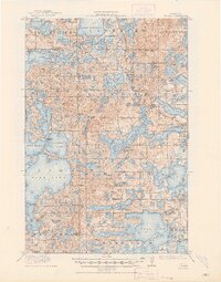
Vergas serves as the primary hub along the Minneapolis St Paul and Sault Ste Marie rail corridor in this pre-war portrait of Otter Tail County. The landscape is defined by its glacial hydrology, with a dense concentration of water bodies including Lake Melissa, Lake Lizzie, and Crystal Lake. Early infrastructure and industry are evident at Bucks Mills on the Mill Pond and the Patterson Bridge crossing. The density of rural education is a striking feature of this era, with nearly two dozen numbered schoolhouses, such as School No 161 and the Jacobs School, scattered throughout the townships of Dora, Lida, and Candor. For those tracing family history, the map identifies specific stops like the Pelican Inn and Websters Inn, marking the region's early identity as a destination for travelers and lake-goers.
Find a feature on this map
90 named features on this map. Tap any name to fly to it.
Don’t see what you’re looking for? This feature index may not catch every label — zoom into the map to look around manually.
Map Details
Editions of this 1915 Vergas Map
6 editions found
Other maps of this area

1912 · Vergas
USGS Topo · 1:62,500

1912 · Battle Lake
USGS Topo · 1:62,500

1913 · Fergus Falls
USGS Topo · 1:62,500

1914 · Battle Lake
USGS Topo · 1:62,500

1914 · Pelican Rapids
USGS Topo · 1:62,500

1915 · Underwood
USGS Topo · 1:62,500

1915 · Perham
USGS Topo · 1:62,500

1915 · Vergas
USGS Topo · 1:62,500

1917 · Pelican Rapids
USGS Topo · 1:62,500

1953 · Fargo
USGS Topo · 1:250,000
Featured Places
- Lake Eunice, MN
- Vergas, MN
- Bucks Mill, MN
- Heisler Manufactured Home Park, MN
- Mavis Frazier Trailer Park, MN