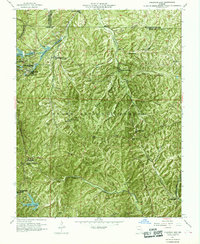
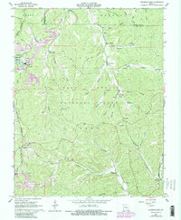
1967 Map of Viburnum East
USGS Topo · Published 1969About this map
The Viburnum Mine and Magmont Mine anchor this late-1960s survey of Iron County, Missouri, highlighting the industrial landscape of the Viburnum Trend. These lead mining operations, complete with Tailings ponds and a Landing Strip, contrast with the traditional rural settlements of Bixby and Goodland. The rugged terrain of the Clark National Forest is deeply incised by drainages like Courtois Creek and the Middle Fork Black River, which dictate the placement of local roads and the small forest communities.
Find a feature on this map
34 named features on this map. Tap any name to fly to it.
Don’t see what you’re looking for? This feature index may not catch every label — zoom into the map to look around manually.
Map Details
Editions of this 1967 Viburnum East Map
5 editions found
Other maps of this area

1906 · Potosi
USGS Topo · 1:62,500

1924 · Edgehill
USGS Topo · 1:62,500

1926 · Edgehill
USGS Topo · 1:62,500

1943 · Berryman
USGS Topo · 1:62,500

1943 · Boss
USGS Topo · 1:62,500

1945 · Berryman
USGS Topo · 1:62,500

1946 · Boss
USGS Topo · 1:62,500

1949 · Rolla
USGS Topo · 1:250,000

1953 · Rolla
USGS Topo · 1:250,000

1954 · Rolla
USGS Topo · 1:250,000