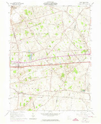
1961 Map of Vienna
USGS Topo · Published 1974About this map
Vienna (South Vienna PO) serves as a primary hub for this central Ohio landscape, situated along the storied National Road. The map reveals a transition from traditional agricultural patterns to early modern infrastructure, with the Penn Central rail line cutting across the southern portion through Plattsburg. To the east, the extensive grounds of the London Correctional Institution and the State Fish Hatchery mark significant state land use near Oak Run. Local heritage is well-preserved through numerous family and community landmarks, including McConkey Cem, Bodkin Cem, and the historic Pleasant Chapel. The terrain is defined by its many waterways, such as the headwaters of the Little Miami River and the meandering Beaver Creek, reflecting a well-watered region where small settlements like Brighton and Summerford once relied heavily on these drainage basins and early turnpikes like Old Columbus Road.
Find a feature on this map
45 named features on this map. Tap any name to fly to it.
Don’t see what you’re looking for? This feature index may not catch every label — zoom into the map to look around manually.
Map Details
Editions of this 1961 Vienna Map
Other maps of this area

1907 · London
USGS Topo · 1:62,500

1907 · South Charleston
USGS Topo · 1:62,500

1914 · Mechanicsburg
USGS Topo · 1:62,500

1916 · Mechanicsburg
USGS Topo · 1:62,500

1916 · Milford Center
USGS Topo · 1:62,500

1944 · Mechanicsburg
USGS Topo · 1:62,500

1944 · Milford Center
USGS Topo · 1:62,500

1947 · Columbus
USGS Topo · 1:250,000

1950 · Marion
USGS Topo · 1:250,000

1961 · Columbus
USGS Topo · 1:250,000