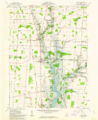
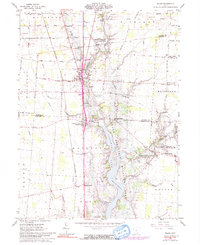
1961 Map of Waldo
USGS Topo · Published 1963About this map
The Olentangy River and Whetstone Creek converge within the southern reach of this 1961 survey, where the rising waters of the Delaware Reservoir have reshaped the central landscape. The surrounding agricultural terrain is defined by a dense network of family-named corners and rural cemeteries, reflecting the deeply rooted settlement patterns of Marlboro and Richland townships. Numerous small burying grounds, including Wolfinger Cem, Augenstein Cem, and Berringer Cem, are scattered across the plains, serving as vital landmarks for genealogical research. The village of Waldo sits at a strategic junction in the north, while smaller settlements like Norton and Troyton anchor the western reaches. The transition of former farmland into the Delaware Reservoir Wildlife Area illustrates the mid-century shift toward large-scale water management and conservation in this part of Ohio.
Find a feature on this map
54 named features on this map. Tap any name to fly to it.
Don’t see what you’re looking for? This feature index may not catch every label — zoom into the map to look around manually.
Map Details
Editions of this 1961 Waldo Map
5 editions found
Other maps of this area

1903 · Marion
USGS Topo · 1:62,500

1905 · Marion
USGS Topo · 1:62,500

1913 · Mount Gilead
USGS Topo · 1:62,500

1915 · Marengo
USGS Topo · 1:62,500

1916 · Mount Gilead
USGS Topo · 1:62,500

1924 · Delaware
USGS Topo · 1:62,500

1925 · Delaware
USGS Topo · 1:62,500

1943 · Marengo
USGS Topo · 1:62,500

1943 · Mount Gilead
USGS Topo · 1:62,500

1944 · Delaware
USGS Topo · 1:62,500