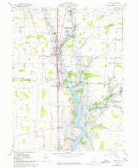
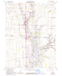
1961 Map of Waldo
USGS Topo · Published 1974About this map
The Olentangy River and the expanding Delaware Reservoir Lake dominate this central Ohio landscape, reflecting mid-century water management and recreation efforts. The village of Waldo sits at a crossroads of commerce and transit, served by the Penn Central railroad and a network of arterial roads like Western Road. To the south, the settlement of Norton and landmarks such as Inskeep Corners provide evidence of earlier rural clusters that defined the region before the reservoir's inundation altered the terrain.
Find a feature on this map
64 named features on this map. Tap any name to fly to it.
Don’t see what you’re looking for? This feature index may not catch every label — zoom into the map to look around manually.
Map Details
Editions of this 1961 Waldo Map
5 editions found
Other maps of this area

1903 · Marion
USGS Topo · 1:62,500

1905 · Marion
USGS Topo · 1:62,500

1913 · Mount Gilead
USGS Topo · 1:62,500

1915 · Marengo
USGS Topo · 1:62,500

1916 · Mount Gilead
USGS Topo · 1:62,500

1924 · Delaware
USGS Topo · 1:62,500

1925 · Delaware
USGS Topo · 1:62,500

1943 · Marengo
USGS Topo · 1:62,500

1943 · Mount Gilead
USGS Topo · 1:62,500

1944 · Delaware
USGS Topo · 1:62,500