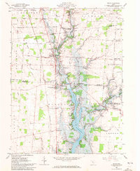
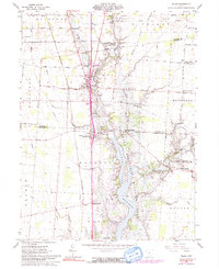
1961 Map of Waldo
USGS Topo · Published 1972About this map
The Olentangy River serves as the central geographic axis of this Marion County and Delaware County region during the early 1960s. The landscape is defined by the Delaware Reservoir and its surrounding Wildlife Area, a significant water body created to manage the local river system. The village of Waldo is the primary population center, situated near the intersection of various rural roads like Western Road and the Pennsylvania rail line. This survey captures a moment when smaller, crossroads-style settlements like Smith Corners, Mayfield Corners, and Inskeep Corners remained distinct reference points on the map.
Find a feature on this map
49 named features on this map. Tap any name to fly to it.
Don’t see what you’re looking for? This feature index may not catch every label — zoom into the map to look around manually.
Map Details
Editions of this 1961 Waldo Map
5 editions found
Other maps of this area

1903 · Marion
USGS Topo · 1:62,500

1905 · Marion
USGS Topo · 1:62,500

1913 · Mount Gilead
USGS Topo · 1:62,500

1915 · Marengo
USGS Topo · 1:62,500

1916 · Mount Gilead
USGS Topo · 1:62,500

1924 · Delaware
USGS Topo · 1:62,500

1925 · Delaware
USGS Topo · 1:62,500

1943 · Marengo
USGS Topo · 1:62,500

1943 · Mount Gilead
USGS Topo · 1:62,500

1944 · Delaware
USGS Topo · 1:62,500