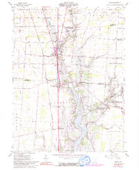
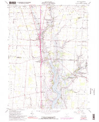
1961 Map of Waldo
USGS Topo · Published 1991About this map
The Olentangy River and Whetstone Creek converge in this central Ohio landscape, shaped by the waters of the Delaware Reservoir Lake. The village of Waldo serves as a primary hub, situated near the historic Treaty Line that cuts across the northern townships. This 1961 survey captures a rural network of small communities and family landmarks, including Bethlehem, Norton, and Lynn. Genealogists can trace numerous burial grounds such as Wolfinger Cem, Augenstein Cem, and Drake Cem, which are scattered throughout the agricultural tracts. Transportation is defined by the Penn Central corridor and a series of rural routes like Newmans Cardington Road. The presence of the Delaware Reservoir Landing Strip and the Delaware Reservoir Wildlife Area reflects the mid-century integration of public recreation and conservation into the traditional farming landscape.
Find a feature on this map
60 named features on this map. Tap any name to fly to it.
Don’t see what you’re looking for? This feature index may not catch every label — zoom into the map to look around manually.
Map Details
Editions of this 1961 Waldo Map
5 editions found
Other maps of this area

1903 · Marion
USGS Topo · 1:62,500

1905 · Marion
USGS Topo · 1:62,500

1913 · Mount Gilead
USGS Topo · 1:62,500

1915 · Marengo
USGS Topo · 1:62,500

1916 · Mount Gilead
USGS Topo · 1:62,500

1924 · Delaware
USGS Topo · 1:62,500

1925 · Delaware
USGS Topo · 1:62,500

1943 · Marengo
USGS Topo · 1:62,500

1943 · Mount Gilead
USGS Topo · 1:62,500

1944 · Delaware
USGS Topo · 1:62,500