
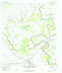
1960 Map of Wallis
USGS Topo · Published 1961About this map
The Brazos River meanders sharply through this landscape, defining the convergence of Austin, Waller, and Fort Bend Counties. Near the center of the survey, a marshy depression known as Alligator Hole sits between the river and Allens Creek, illustrating the low-lying prairie terrain of the era. The settlement of Wallis serves as a transportation hub where the Gulf Colorado and Santa Fe and the Texas and New Orleans railroads intersect.
Find a feature on this map
31 named features on this map. Tap any name to fly to it.
Don’t see what you’re looking for? This feature index may not catch every label — zoom into the map to look around manually.
Map Details
Editions of this 1960 Wallis Map
3 editions found
Other maps of this area

1950 · Houston
USGS Topo · 1:250,000

1953 · Seguin
USGS Topo · 1:250,000

1955 · Brookshire
USGS Topo · 1:62,500

1955 · Richmond
USGS Topo · 1:62,500

1956 · Sealy
USGS Topo · 1:62,500

1956 · Wallis
USGS Topo · 1:62,500

1956 · Houston
USGS Topo · 1:250,000

1958 · Seguin
USGS Topo · 1:250,000

1960 · Lissie
USGS Topo · 1:24,000

1960 · San Felipe
USGS Topo · 1:24,000