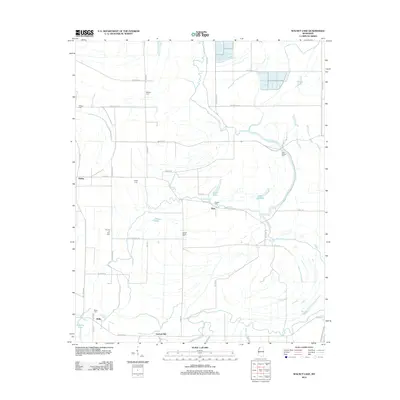
2012 Map of Walnut Lake
USGS Topo · Published 2012About this map
White Oak Bayou and Seven Mile Bayou define the hydrologic character of this Mississippi Delta landscape, winding through a network of agricultural lands and scattered settlements. The area is marked by numerous small community burial grounds, including Bethany Cem, Daygo Cem, and Dooley Wood Cem, which serve as vital markers for genealogical research in this rural portion of Tunica County. Small population centers like Dubbs, Pink, and Hally are connected by a grid of named rural routes such as Limerick Rd and Bonnie Blue Rd.
Find a feature on this map
54 named features on this map. Tap any name to fly to it.
Don’t see what you’re looking for? This feature index may not catch every label — zoom into the map to look around manually.
Map Details
Editions of this 2012 Walnut Lake Map
This is the sole edition of this map. No revisions or reprints were ever made.
Other maps of this area

1908 · Lula
USGS Topo · 1:24,000

1908 · Dundee
USGS Topo · 1:24,000

1908 · Hollywood
USGS Topo · 1:24,000

1908 · Walnut Lake
USGS Topo · 1:24,000

1910 · Dundee
USGS Topo · 1:31,680

1910 · Walnut Lake
USGS Topo · 1:31,680

1912 · Lula
USGS Topo · 1:31,680

1913 · Hollywood
USGS Topo · 1:31,680

1932 · Sledge
USGS Topo · 1:48,000

1932 · Marks
USGS Topo · 1:48,000