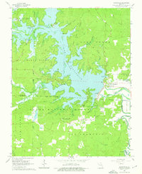
1966 Map of Wappapello
USGS Topo · Published 1976About this map
Lake Wappapello dominates this mid-1960s landscape, its irregular shoreline reaching into the deep hollows of the Clark National Forest. The engineering of the Wappapello Dam on the St Francis River created a massive reservoir that altered the local geography, inundating former river bottoms while creating new recreational points like Chaonia Landing Recreation Area and Sanderson Point.
Find a feature on this map
56 named features on this map. Tap any name to fly to it.
Don’t see what you’re looking for? This feature index may not catch every label — zoom into the map to look around manually.
Map Details
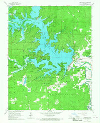
Editions of this 1966 Wappapello Map
2 editions found
Other maps of this area

1934 · Greenville
USGS Topo · 1:62,500

1934 · Puxico
USGS Topo · 1:62,500

1935 · Poplar Bluff
USGS Topo · 1:62,500

1935 · Zalma
USGS Topo · 1:62,500

1939 · Greenville
USGS Topo · 1:62,500

1939 · Puxico
USGS Topo · 1:62,500

1939 · Zalma
USGS Topo · 1:62,500

1939 · Poplar Bluff
USGS Topo · 1:62,500

1949 · Rolla
USGS Topo · 1:250,000

1949 · Poplar Bluff
USGS Topo · 1:62,500