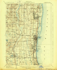
1908 Map of Waukegan
USGS Topo · Published 1929About this map
The industrial and military shoreline of Lake Michigan dominates this early twentieth-century landscape, anchored by Waukegan, North Chicago, and the religious community of Zion City. Inland, the terrain transitions into a dense network of crossroads settlements and rural institutions, reflecting the agricultural character of Lake County before mid-century suburbanization. The Des Plaines River winds south through the center of the sheet, flanked by the Milwaukee Road and a series of family-named corners such as Gurnee Corners and Dillys Corners.
Find a feature on this map
94 named features on this map. Tap any name to fly to it.
Don’t see what you’re looking for? This feature index may not catch every label — zoom into the map to look around manually.
Map Details
Editions of this 1908 Waukegan Map
5 editions found
Other maps of this area

1892 · Racine
USGS Topo · 1:62,500

1893 · Silver Lake
USGS Topo · 1:62,500

1899 · Evanston
USGS Topo · 1:62,500

1900 · Highwood
USGS Topo · 1:62,500

1905 · Racine
USGS Topo · 1:62,500

1906 · Silver Lake
USGS Topo · 1:62,500

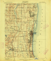
1906 · Waukegan
USGS Topo · 1:62,500

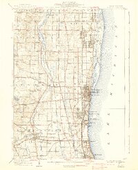
1908 · Waukegan
USGS Topo · 1:62,500

1920 · Grays Lake
USGS Topo · 1:62,500

1923 · Grays Lake
USGS Topo · 1:62,500