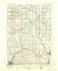
1906 Map of Waukesha
USGS Topo · Published 1934About this map
The Fox River and Menomonee River carve through the glacial landscape of southeastern Wisconsin at the turn of the century. This survey, conducted in the 1890s, documents a transition from rural agricultural townships like Germantown and Mequon into more established hubs. Significant industrial activity is evident in settlements like Lannon, known for its limestone, and Menomonee Falls, where the river provided early power. The rail infrastructure is exceptionally dense, featuring the Chicago Milwaukee and St. Paul Railroad and the Wisconsin Central Railroad Main Line, which facilitated the growth of towns like Sussex, Templeton, and Wauwatosa. In the north, small water bodies such as Bark Lake and Amy Belle Lake dot the township of Richfield, while the burgeoning outskirts of Milwaukee appear in the east through communities like North Greenfield and Butler.
Find a feature on this map
58 named features on this map. Tap any name to fly to it.
Don’t see what you’re looking for? This feature index may not catch every label — zoom into the map to look around manually.
Map Details
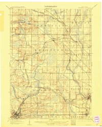
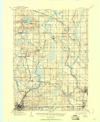
Editions of this 1906 Waukesha Map
4 editions found

Other maps of this area

1891 · Bayview
USGS Topo · 1:62,500

1891 · Muskego
USGS Topo · 1:62,500

1892 · Milwaukee
USGS Topo · 1:62,500

1892 · Waukesha
USGS Topo · 1:62,500

1892 · Oconomowoc
USGS Topo · 1:62,500

1892 · Port Washington
USGS Topo · 1:62,500

1892 · Eagle
USGS Topo · 1:62,500

1894 · Eagle
USGS Topo · 1:62,500

1897 · Eagle
USGS Topo · 1:62,500

1901 · Milwaukee
USGS Topo · 1:62,500