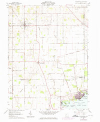
1961 Map of Waynesfield
USGS Topo · Published 1975About this map
The agricultural landscape of Auglaize County is defined by its deep historical boundaries and the headwaters of the Scioto River. This survey illustrates the intricate township grid where Wayne, Goshen, and Stokes meet, including the unique diagonal line of the Virginia Military Lands District and the Treaty Line. Small settlements like Waynesfield and New Hampshire serve as local hubs, connected by a network of named country pikes such as Waynesfield Pike and Blank Pike.
Find a feature on this map
63 named features on this map. Tap any name to fly to it.
Don’t see what you’re looking for? This feature index may not catch every label — zoom into the map to look around manually.
Map Details
Editions of this 1961 Waynesfield Map
3 editions found
Other maps of this area

1906 · Lima
USGS Topo · 1:62,500

1913 · Alger
USGS Topo · 1:48,000

1913 · Bellefontaine
USGS Topo · 1:48,000

1913 · Sidney
USGS Topo · 1:62,500

1915 · Alger
USGS Topo · 1:62,500

1915 · Bellefontaine
USGS Topo · 1:62,500

1943 · Alger
USGS Topo · 1:62,500

1944 · Sidney
USGS Topo · 1:62,500

1944 · Bellefontaine
USGS Topo · 1:62,500

1950 · Marion
USGS Topo · 1:250,000