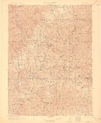
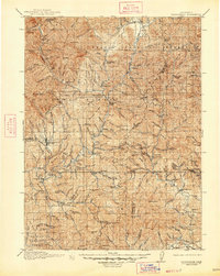
1913 Map of Weaverville
USGS Topo · Published 1913About this map
The East Fork Trinity River and its myriad tributaries dominate this 1911 survey of Northern California gold country. The landscape is defined by extensive hydraulic and hard-rock mining operations, most notably the massive La Grange Mine west of Weaverville and the Union Hill Mine near Douglas City. These industrial sites represent a peak era of resource extraction within the Trinity National Forest and Shasta National Forest, where steep gulches like Deadwood Gulch and Eastman Gulch provided the water and gravity essential for mineral processing. Remote family outposts including Adams Ranch and Bowermans Ranch dot the rugged interior, while early postal hubs like Minersville PO served a population scattered across high peaks such as Bully Choop Mtn and Shasta Bally. The map documents the intricate network of water rights and early roads connecting Whiskeytown to the county seat.
Find a feature on this map
132 named features on this map. Tap any name to fly to it.
Don’t see what you’re looking for? This feature index may not catch every label — zoom into the map to look around manually.
Map Details
Editions of this 1913 Weaverville Map
6 editions found
Other maps of this area

1886 · Shasta
USGS Topo · 1:250,000

1890 · Red Bluff
USGS Topo · 1:250,000

1894 · Red Bluff
USGS Topo · 1:250,000

1894 · Shasta
USGS Topo · 1:250,000

1901 · Redding
USGS Topo · 1:125,000

1909 · Big Bar
USGS Topo · 1:96,000

1913 · Weaverville
USGS Topo · 1:125,000

1915 · Big Bar and Vicinity
USGS Topo · 1:250,000

1923 · Sawyers Bar
USGS Topo · 1:125,000

1931 · Hoaglin
USGS Topo · 1:96,000