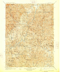
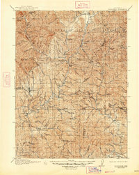
1913 Map of Weaverville
USGS Topo · Published 1928About this map
Weaverville serves as the focal point for this 1911 survey of Northern California gold country, a landscape defined by its deep mining heritage and the rugged interface between Shasta National Forest and Trinity National Forest. The map documents a significant industrial era where large-scale operations like the La Grange Mine and Globe Mine operated alongside remote homesteads. The Trinity River winds through the center of the sheet, connecting established settlements like Lewiston and Douglas City with scattered pioneer outposts such as Bowermans Ranch and Adams Ranch. This record is particularly valuable for tracing early 20th-century hydrology and resource extraction, capturing the location of numerous workings including the Niagara Mine and Bully Choop Mine before modern landscape alterations. The presence of Minersville and Whiskeytown highlights the region's primary economic drivers during this reprinted 1928 edition.
Find a feature on this map
123 named features on this map. Tap any name to fly to it.
Don’t see what you’re looking for? This feature index may not catch every label — zoom into the map to look around manually.
Map Details
Editions of this 1913 Weaverville Map
6 editions found
Other maps of this area

1886 · Shasta
USGS Topo · 1:250,000

1890 · Red Bluff
USGS Topo · 1:250,000

1894 · Red Bluff
USGS Topo · 1:250,000

1894 · Shasta
USGS Topo · 1:250,000

1901 · Redding
USGS Topo · 1:125,000

1909 · Big Bar
USGS Topo · 1:96,000

1913 · Weaverville
USGS Topo · 1:125,000

1915 · Big Bar and Vicinity
USGS Topo · 1:250,000

1923 · Sawyers Bar
USGS Topo · 1:125,000

1931 · Hoaglin
USGS Topo · 1:96,000