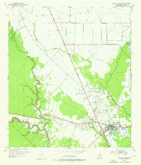
1952 Map of West Columbia
USGS Topo · Published 1976About this map
Industrial energy and coastal prairie drainage define this mid-century survey of Brazoria County. The town of West Columbia serves as a central hub, flanked by the sprawling West Columbia Oil Field. The landscape is a network of production and transport, marked by a massive Tank Farm, numerous Oil Tanks, and a web of Pipe Line corridors that crisscross the low-lying terrain. These man-made features contrast with the natural winding course of the San Bernard River and its tributaries.
Find a feature on this map
13 named features on this map. Tap any name to fly to it.
Don’t see what you’re looking for? This feature index may not catch every label — zoom into the map to look around manually.
Map Details
Editions of this 1952 West Columbia Map
4 editions found
Other maps of this area

1950 · Houston
USGS Topo · 1:250,000

1952 · West Columbia
USGS Topo · 1:24,000

1952 · Sweeny
USGS Topo · 1:24,000

1952 · Danciger
USGS Topo · 1:24,000

1952 · Ashwood
USGS Topo · 1:24,000

1952 · East Columbia
USGS Topo · 1:24,000

1952 · Brazoria
USGS Topo · 1:24,000

1953 · Guy
USGS Topo · 1:24,000

1953 · Damon
USGS Topo · 1:24,000

1953 · Otey
USGS Topo · 1:24,000