
1957 Map of West Monroe North
USGS Topo · Published 1958About this map
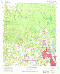
The Ouachita River defines the eastern boundary of this mid-century landscape, where the urban expansion of West Monroe meets the intricate bayou networks of northern Louisiana. The map reveals a transition from the dense residential grid of the city, featuring landmarks like Boley High Sch and Hasley Cem, to the rural hinterlands where names like Drew, Hendricks, and Claiborne mark established settlements. The hydrology is particularly complex, characterized by the winding course of Bayou D'Arbonne and Choudrant Bayou amidst low-lying terrain labeled simply as Field.
Find a feature on this map
55 named features on this map. Tap any name to fly to it.
Don’t see what you’re looking for? This feature index may not catch every label — zoom into the map to look around manually.
Map Details
Editions of this 1957 West Monroe North Map
4 editions found
Other maps of this area

1935 · Drew
USGS Topo · 1:62,500

1940 · Monroe
USGS Topo · 1:62,500

1952 · Calhoun
USGS Topo · 1:62,500

1953 · Chatham
USGS Topo · 1:62,500

1955 · Shreveport
USGS Topo · 1:250,000

1956 · Shreveport
USGS Topo · 1:250,000

1957 · Monroe North
USGS Topo · 1:62,500

1957 · West Monroe South
USGS Topo · 1:24,000

1957 · Monroe South
USGS Topo · 1:24,000

1957 · Monroe South
USGS Topo · 1:62,500