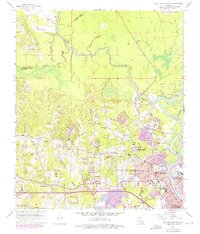
1957 Map of West Monroe North
USGS Topo · Published 1975About this map
Bayou D'Arbonne and the Ouachita River converge north of West Monroe and Monroe, defining a landscape where river bottomlands meet developing urban residential grids. In the mid-1950s, the area shows significant expansion northward from the city centers, with newer neighborhoods like Kirili Woods appearing alongside established landmarks such as the Golf Course and Forsythe Park. To the west, the terrain becomes more rural and wooded, dotted with numerous small community centers and country churches including Goodhope Ch, Dean Chapel, and Chapel Hill Ch. Researchers can trace the path of the Illinois Central Gulf railroad as it skirts the southern edge of town, while industrial sites and resource extraction are visible at the various Pits near the river. Significant local genealogy resources appear across the sheet, from the large Hasley Cem to smaller family burial grounds like Nash Cem and Drew Cem.
Find a feature on this map
68 named features on this map. Tap any name to fly to it.
Don’t see what you’re looking for? This feature index may not catch every label — zoom into the map to look around manually.
Map Details
Editions of this 1957 West Monroe North Map
4 editions found
Other maps of this area

1935 · Drew
USGS Topo · 1:62,500

1940 · Monroe
USGS Topo · 1:62,500

1952 · Calhoun
USGS Topo · 1:62,500

1953 · Chatham
USGS Topo · 1:62,500

1955 · Shreveport
USGS Topo · 1:250,000

1956 · Shreveport
USGS Topo · 1:250,000

1957 · Monroe North
USGS Topo · 1:62,500

1957 · West Monroe North
USGS Topo · 1:24,000

1957 · West Monroe South
USGS Topo · 1:24,000

1957 · Monroe South
USGS Topo · 1:24,000