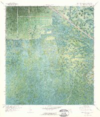
1970 Map of West Palm Beach 2 NW
USGS Topo · Published 1976About this map
The Corbett State Wildlife Management Area dominates this orthophotomap, revealing the intricate patterns of Florida's wet prairies and marshy lowlands at the start of the 1970s. This specific aerial-based topographic study captures the boundary between Martin Co and Palm Beach Co, where the natural drainage of the Everglades meets emerging infrastructure. To the northwest, the Seaboard Coast Line railroad cuts a straight path through the wetlands, accompanied by scattered technical infrastructure such as a Pump, Substation, and Water Tank. Of particular archaeological and historical interest are the elevations of Big Mound and Indian Mound, which provide rare vertical relief and evidence of early human habitation within the otherwise saturated landscape. The map serves as a detailed record of the region's hydrography and land use before subsequent decades of development.
Find a feature on this map
8 named features on this map. Tap any name to fly to it.
Don’t see what you’re looking for? This feature index may not catch every label — zoom into the map to look around manually.
Map Details
Editions of this 1970 West Palm Beach 2 NW Map
3 editions found
Other maps of this area

1953 · Okeechobee 4 SE
USGS Topo · 1:24,000

1953 · Indian Town SE
USGS Topo · 1:24,000

1953 · Indian Town
USGS Topo · 1:24,000

1956 · West Palm Beach
USGS Topo · 1:250,000

1956 · Fort Pierce
USGS Topo · 1:250,000

1957 · West Palm Beach
USGS Topo · 1:250,000

1958 · Fort Pierce
USGS Topo · 1:250,000

1958 · West Palm Beach
USGS Topo · 1:250,000

1959 · Fort Pierce
USGS Topo · 1:250,000

1970 · West Palm Beach 2 SW
USGS Topo · 1:24,000