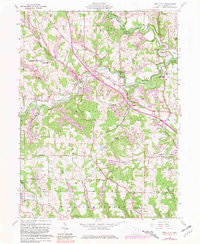
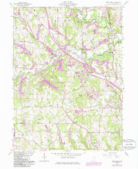
1960 Map of West Point
USGS Topo · Published 1981About this map
West Point sits at the intersection of early Ohio surveying history and mid-century industry, where the Geographers Line marks a significant boundary across the terrain. The landscape is defined by the winding paths of the West Fork Little Beaver Creek and the Middle Fork Little Beaver Creek, which converge within the protected acreage of Beaver Creek State Park. Evidence of the region's extraction economy is visible in the numerous Strip Mines and Gas Well sites that dot the hillsides surrounding Rock Camp and Glasgow.
Find a feature on this map
50 named features on this map. Tap any name to fly to it.
Don’t see what you’re looking for? This feature index may not catch every label — zoom into the map to look around manually.
Map Details
Editions of this 1960 West Point Map
5 editions found
Other maps of this area

1904 · Wellsville
USGS Topo · 1:62,500

1905 · Salineville
USGS Topo · 1:62,500

1907 · Columbiana
USGS Topo · 1:62,500

1909 · Lisbon
USGS Topo · 1:62,500

1909 · Columbiana
USGS Topo · 1:62,500

1937 · Wellsville
USGS Topo · 1:62,500

1944 · Wellsville
USGS Topo · 1:62,500

1951 · Canton
USGS Topo · 1:250,000

1953 · Canton
USGS Topo · 1:250,000

1957 · Canton
USGS Topo · 1:250,000