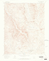
1963 Map of Wetterhorn Peak
USGS Topo · Published 1966About this map
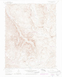
Uncompahgre National Forest spans this high-elevation landscape, where the jagged skyline is defined by Wetterhorn Peak and Precipice Peak. In the early 1960s, this area of the San Juan Mountains remained a primitive frontier for mining and exploration, marked by a network of steep trails and the occasional Mine or Prospect. The map documents a transition in mountain access, showing traditional pack routes like the Cow Creek Trail alongside newer motorized paths including the Henson Creek Jeep Trail. The terrain drops from the sharp summits into alpine basins such as Wetterhorn Basin and Porphyry Basin, where glacial action has left distinctive features like American Lake. Along the Ouray Co Hinsdale Co line, the geography is characterized by deep drainages like Difficulty Creek and Wildhorse Creek, illustrating the complex watershed that feeds the E Fk Cimarron River and Henson Creek.
Find a feature on this map
38 named features on this map. Tap any name to fly to it.
Don’t see what you’re looking for? This feature index may not catch every label — zoom into the map to look around manually.
Map Details
Editions of this 1963 Wetterhorn Peak Map
7 editions found
Other maps of this area

1897 · Silverton
USGS Topo · 1:62,500

1901 · Silverton
USGS Topo · 1:62,500

1902 · Silverton
USGS Topo · 1:62,500

1902 · Ouray
USGS Topo · 1:62,500

1903 · Lake City
USGS Topo · 1:62,500

1904 · Ouray
USGS Topo · 1:62,500

1905 · Lake City
USGS Topo · 1:62,500

1905 · San Cristobal
USGS Topo · 1:125,000

1907 · San Cristobal
USGS Topo · 1:125,000

1908 · Uncompahgre
USGS Topo · 1:125,000