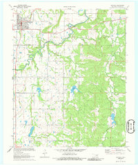
1971 Map of Wetumka
USGS Topo · Published 1986About this map
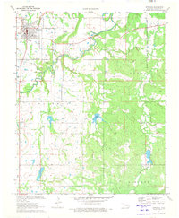
Wetumka serves as the primary hub in this early 1970s landscape, situated at the intersection of the St L-S F railroad and local highways. The map reveals an area defined by its energy and aviation resources, notably the Wetumka Gas Field and Petes Airpark south of the town center. Local heritage is preserved in numerous rural landmarks, including the Wetumka Cemetery and Barnett Cem, along with several country congregations such as Lone Star Ch and Pleasant Ridge Ch. Waterways like Wewoka Creek and Greasy Creek wind through the terrain, supporting local sites like the Fish Hatchery and Brooks Lake. The presence of scattered oil wells and gravel pits among the ranch lands reflects the region's mid-century industrial footprint.
Find a feature on this map
28 named features on this map. Tap any name to fly to it.
Don’t see what you’re looking for? This feature index may not catch every label — zoom into the map to look around manually.
Map Details
Editions of this 1971 Wetumka Map
2 editions found
Other maps of this area

1900 · Wewoka
USGS Topo · 1:125,000

1954 · Oklahoma City
USGS Topo · 1:250,000

1957 · Oklahoma City
USGS Topo · 1:250,000

1963 · Oklahoma City
USGS Topo · 1:250,000

1967 · Okemah SE
USGS Topo · 1:24,000

1967 · Weleetka
USGS Topo · 1:24,000
1967 · Dustin
USGS Topo · 1:24,000
1970 · Lamar
USGS Topo · 1:24,000
1971 · Wetumka SE
USGS Topo · 1:24,000
1971 · Wetumka
USGS Topo · 1:24,000