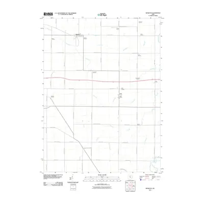
2010 Map of Wharton
USGS Topo · Published 2010About this map
Wharton and Kirby anchor this section of Wyandot County, showcasing a landscape defined by highly regular agricultural surveying and an extensive drainage network. The terrain is crisscrossed by numerous named waterways, including Potato Run, Baughman Run, and Oak Run, alongside man-made improvements like Blake Ditch. These watercourses dictate the subtle shifts in the otherwise geometric grid of township and county highways that partition the farmland.
Find a feature on this map
55 named features on this map. Tap any name to fly to it.
Don’t see what you’re looking for? This feature index may not catch every label — zoom into the map to look around manually.
Map Details
Editions of this 2010 Wharton Map
This is the sole edition of this map. No revisions or reprints were ever made.
Other maps of this area

1905 · Arlington
USGS Topo · 1:62,500

1907 · Arlington
USGS Topo · 1:24,000

1907 · Upper Sandusky
USGS Topo · 1:62,500

1915 · Kenton
USGS Topo · 1:62,500

1915 · La Rue
USGS Topo · 1:62,500

1944 · Kenton
USGS Topo · 1:62,500

1950 · Marion
USGS Topo · 1:250,000

1960 · Upper Sandusky
USGS Topo · 1:24,000

1960 · Mt Blanchard
USGS Topo · 1:24,000

1960 · Marseilles
USGS Topo · 1:24,000