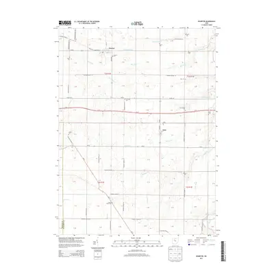
2013 Map of Wharton
USGS Topo · Published 2013About this map
Wharton and Kirby serve as the primary hubs in this agricultural section of Wyandot County. The landscape is defined by a dense network of township roads and drainage systems like Potato Run and Baughman Run, reflecting the region's managed hydrology for farming. This map is particularly significant for genealogical research, documenting numerous family-named burial sites such as Spoon Cem, Murray Cem, and Inman Cem. The southern reach of the survey is marked by Tymochtee Creek and the marshy area known as The Outlet, while major transit corridors including Us-30 and Oh-37 bisect the patchwork of rural sections. The high density of small cemeteries compared to the limited number of village centers illustrates the deeply rooted, decentralized settlement pattern of the area.
Find a feature on this map
55 named features on this map. Tap any name to fly to it.
Don’t see what you’re looking for? This feature index may not catch every label — zoom into the map to look around manually.
Map Details
Editions of this 2013 Wharton Map
This is the sole edition of this map. No revisions or reprints were ever made.
Other maps of this area

1905 · Arlington
USGS Topo · 1:62,500

1907 · Arlington
USGS Topo · 1:24,000

1907 · Upper Sandusky
USGS Topo · 1:62,500

1915 · Kenton
USGS Topo · 1:62,500

1915 · La Rue
USGS Topo · 1:62,500

1944 · Kenton
USGS Topo · 1:62,500

1950 · Marion
USGS Topo · 1:250,000

1960 · Upper Sandusky
USGS Topo · 1:24,000

1960 · Mt Blanchard
USGS Topo · 1:24,000

1960 · Marseilles
USGS Topo · 1:24,000