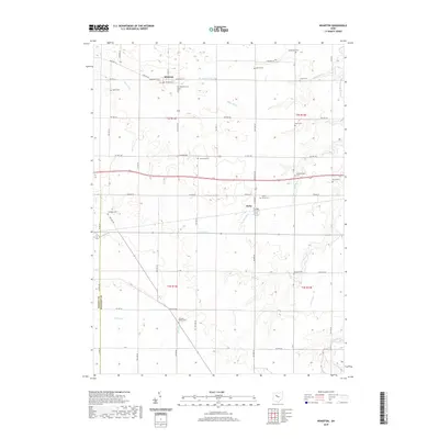
2019 Map of Wharton
USGS Topo · Published 2019About this map
Wharton and Kirby anchor this agricultural landscape in northwestern Ohio, where the terrain is defined by an intricate network of drainage and small waterways. The township lines of T2S R12E and T2S R13E meet near the Hardin and Wyandot county line, illustrating the rigid grid of the Public Land Survey System. Water management is central to the area's history, evidenced by features like The Outlet, Blake Ditch, and Potato Run. For genealogists and local historians, the map is remarkably dense with family and community burial sites. These range from the centrally located Saint Marys Cem and Schoenberger Cem to more isolated sites such as Spoon Cem, Baughman Cem, and Jackson Center Cem. The road network, including Angling Rd and State Rte 293, connects these scattered landmarks across the Wyandot County countryside.
Find a feature on this map
56 named features on this map. Tap any name to fly to it.
Don’t see what you’re looking for? This feature index may not catch every label — zoom into the map to look around manually.
Map Details
Editions of this 2019 Wharton Map
This is the sole edition of this map. No revisions or reprints were ever made.
Other maps of this area

1905 · Arlington
USGS Topo · 1:62,500

1907 · Arlington
USGS Topo · 1:24,000

1907 · Upper Sandusky
USGS Topo · 1:62,500

1915 · Kenton
USGS Topo · 1:62,500

1915 · La Rue
USGS Topo · 1:62,500

1944 · Kenton
USGS Topo · 1:62,500

1950 · Marion
USGS Topo · 1:250,000

1960 · Upper Sandusky
USGS Topo · 1:24,000

1960 · Mt Blanchard
USGS Topo · 1:24,000

1960 · Marseilles
USGS Topo · 1:24,000