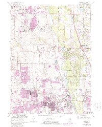
1963 Map of Wheeling
USGS Topo · Published 1988About this map
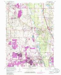
The Des Plaines River corridor serves as the backbone for this portion of Lake and Cook Counties, where suburban expansion meets established rural crossroads. Significant growth in the 1960s and 1970s is evident in the sprawling residential developments of Wheeling and Buffalo Grove, while older hamlets like Aptakisic and Half Day remain visible markers of an earlier era. The map reveals a transition from open landscape to suburban complexity, characterized by the presence of the Chicagoland Airport and the massive Tri-State Tollway cutting through the terrain. Educational and community institutions are prominent, including Wheeling High School, Jack London Jr High School, and the Lake Forest Academy. Along the riverbanks, the Des Plaines River Preserve and Potawatomi Woods offer a preserved look at the region's natural geography amidst the intensifying development of settlements like Lincolnshire and Riverwoods.
Find a feature on this map
84 named features on this map. Tap any name to fly to it.
Don’t see what you’re looking for? This feature index may not catch every label — zoom into the map to look around manually.
Map Details
Editions of this 1963 Wheeling Map
5 editions found
Other maps of this area

1900 · Highwood
USGS Topo · 1:62,500

1906 · Waukegan
USGS Topo · 1:62,500

1908 · Waukegan
USGS Topo · 1:62,500

1920 · Grays Lake
USGS Topo · 1:62,500

1923 · Grays Lake
USGS Topo · 1:62,500

1923 · Barrington
USGS Topo · 1:62,500

1927 · Arlington Heights
USGS Topo · 1:24,000

1928 · Wheeling
USGS Topo · 1:24,000

1928 · Highland Park
USGS Topo · 1:24,000

1929 · Park Ridge
USGS Topo · 1:24,000