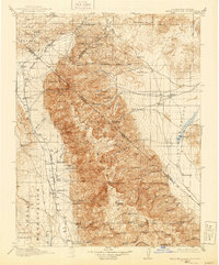
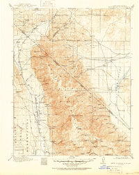
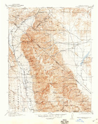
1917 Map of White Mountain
USGS Topo · Published 1940About this map
White Mountain Peak dominates this high-altitude landscape along the border of California and Nevada, anchoring a massive range that rises sharply from the Fish Lake Valley. The region's early 20th-century economy is clearly divided between the mineral-rich slopes and the pastoral lowlands. Dozens of family-run operations like the Dyer Ranch and McNett Ranch line the eastern valley, while the mountains themselves are dotted with remote mining claims including the Tip Top Mine and Black Warrior Mine.
Find a feature on this map
94 named features on this map. Tap any name to fly to it.
Don’t see what you’re looking for? This feature index may not catch every label — zoom into the map to look around manually.
Map Details
Editions of this 1917 White Mountain Map
7 editions found

Other maps of this area

1898 · Silver Peak
USGS Topo · 1:125,000

1900 · Silver Peak
USGS Topo · 1:125,000

1907 · Tonopah
USGS Topo · 1:250,000

1908 · Lida
USGS Topo · 1:250,000

1908 · Tonopah
USGS Topo · 1:250,000

1909 · Hawthorne
USGS Topo · 1:250,000

1911 · Hawthorne
USGS Topo · 1:250,000

1912 · Mt. Goddard
USGS Topo · 1:125,000

1913 · Bishop
USGS Topo · 1:125,000

1913 · Lida
USGS Topo · 1:250,000