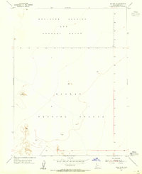
1954 Map of Wig Mtn SW
USGS Topo · Published 1955About this map
Military operations define this 1950s landscape within the Great Salt Lake Desert, where the Dugway Proving Ground and Wendover Bombing and Gunnery Range intersect. The terrain is characterized by broad alluvial flats and sparsely distributed topographical markers, including a small Lake and the survey station at Vabm 4296. This period of the mid-twentieth century saw intense use of these remote Utah lands for defense testing and training, reflected in the large-scale territorial designations that dominate the sheet. Mapping was completed using 1953 aerial photography and 1954 plane-table methods, capturing a moment when military infrastructure was the primary footprint on this arid basin.
Find a feature on this map
7 named features on this map. Tap any name to fly to it.
Don’t see what you’re looking for? This feature index may not catch every label — zoom into the map to look around manually.
Map Details
Editions of this 1954 Wig Mtn SW Map
4 editions found
Other maps of this area

1953 · Tooele
USGS Topo · 1:250,000

1954 · Wig Mtn SW
USGS Topo · 1:24,000

1954 · Dugway Proving Ground NE
USGS Topo · 1:24,000

1954 · Wildcat Mtn
USGS Topo · 1:24,000

1954 · Granite Peak
USGS Topo · 1:24,000

1954 · Wildcat Mtn SE
USGS Topo · 1:24,000

1954 · Dugway Proving Ground NW
USGS Topo · 1:24,000

1954 · Wig Mtn NW
USGS Topo · 1:24,000

1955 · Wig Mtn
USGS Topo · 1:24,000

1955 · Wig Mtn NE
USGS Topo · 1:24,000