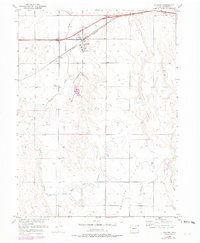
1950 Map of Wiggins
USGS Topo · Published 1979About this map
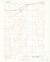
Wiggins serves as the primary hub of this eastern Colorado landscape, situated at the junction of the Burlington railroad and the Northern roadway. The settlement pattern is defined by its proximity to these transportation corridors and the intermittent water sources of the high plains. A local Cem (cemetery) and the Wiggins Substation mark the community's infrastructure during the mid-20th century.
Find a feature on this map
17 named features on this map. Tap any name to fly to it.
Don’t see what you’re looking for? This feature index may not catch every label — zoom into the map to look around manually.
Map Details
Editions of this 1950 Wiggins Map
7 editions found
Other maps of this area

1950 · Wiggins
USGS Topo · 1:24,000

1950 · Wiggins SW
USGS Topo · 1:24,000

1950 · Masters
USGS Topo · 1:24,000

1950 · Hoyt
USGS Topo · 1:24,000

1951 · Hoyt
USGS Topo · 1:24,000

1951 · Masters
USGS Topo · 1:24,000

1951 · Weldona
USGS Topo · 1:24,000

1951 · Orchard
USGS Topo · 1:24,000

1951 · Omar
USGS Topo · 1:24,000

1954 · Sterling
USGS Topo · 1:250,000