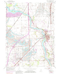
1954 Map of Wilmington
USGS Topo · Published 1984About this map
The Kankakee River winds through this mid-century landscape, anchoring a region defined by industrial extraction and rail transport. Massive Strip Mine operations and numerous Mine Dumps dominate the terrain west of Wilmington, particularly around the rail-side settlements of Braidwood and Diamond. The heavy industrial footprint is balanced by significant institutional and conservation landmarks, such as the Soldiers Widows Home and the Des Plaines Wildlife Conservation Area in the northwest. Local genealogical data is abundant across several townships, including the Olive Cem, Bohemian Cem, and Oak Lawn Cem, alongside rural education sites like the Johnson Sch. The intricate rail network of the Atchison Topeka and Santa Fe and the Gulf Mobile and Ohio railroads highlights the area's role as a transit hub between the coalfields and the Chicago region.
Find a feature on this map
41 named features on this map. Tap any name to fly to it.
Don’t see what you’re looking for? This feature index may not catch every label — zoom into the map to look around manually.
Map Details
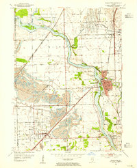
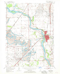
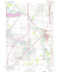
Editions of this 1954 Wilmington Map
4 editions found
Other maps of this area

1892 · Morris
USGS Topo · 1:62,500

1892 · Wilmington
USGS Topo · 1:62,500

1918 · Wilmington
USGS Topo · 1:62,500

1918 · Morris
USGS Topo · 1:62,500

1923 · Herscher
USGS Topo · 1:62,500

1925 · Herscher
USGS Topo · 1:62,500

1948 · Dwight
USGS Topo · 1:62,500

1950 · Dwight
USGS Topo · 1:62,500

1953 · Coal City
USGS Topo · 1:24,000

1953 · Symerton
USGS Topo · 1:24,000