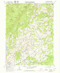
1964 Map of Wilpen
USGS Topo · Published 1979About this map
The industrial and spiritual landscape of the Ligonier Valley is captured in this 1964 survey, highlighting the coal extraction history near Wilpen. Extensive mining operations are evident through numerous Strip Mine sites, Tipple locations, and the Stop Mine northeast of McCalvy Hill. The religious and social fabric of these communities is preserved through records of St Johns Ch, St Anns Ch, and the Bethlen Home, alongside specialized sites like the First Church Camp.
Find a feature on this map
70 named features on this map. Tap any name to fly to it.
Don’t see what you’re looking for? This feature index may not catch every label — zoom into the map to look around manually.
Map Details
Editions of this 1964 Wilpen Map
4 editions found
Other maps of this area

1900 · Latrobe
USGS Topo · 1:62,500

1902 · Latrobe
USGS Topo · 1:62,500

1903 · Latrobe
USGS Topo · 1:62,500

1913 · Somerset
USGS Topo · 1:62,500

1915 · Somerset
USGS Topo · 1:62,500

1920 · New Florence
USGS Topo · 1:62,500

1921 · New Florence
USGS Topo · 1:48,000

1922 · Donegal
USGS Topo · 1:62,500

1922 · New Florence
USGS Topo · 1:62,500

1935 · Donegal
USGS Topo · 1:62,500
Featured Places
- Fairfield Township, PA
- Ligonier Township, PA
- Wilpen, Ligonier Township
- Waterford, Ligonier Township
- Hillsview, Ligonier Township