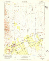
1953 Map of Winters
USGS Topo · Published 1954About this map
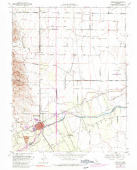
Winters serves as the primary hub on this mid-century survey of the Yolo and Solano county line, where the agricultural landscape meets the foothills. The Southern Pacific rail line cuts a vertical path through the valley, connecting the small settlements of Arroz and Norton to the larger town center. The presence of rural institutions like Buckeye School, Union School, and Wolfskill School illustrates the distributed nature of this farming community before the acceleration of regional development.
Find a feature on this map
20 named features on this map. Tap any name to fly to it.
Don’t see what you’re looking for? This feature index may not catch every label — zoom into the map to look around manually.
Map Details
Editions of this 1953 Winters Map
6 editions found
Other maps of this area

1902 · Napa
USGS Topo · 1:125,000

1905 · Esparto
USGS Topo · 1:24,000

1907 · Woodland
USGS Topo · 1:62,500

1908 · Vacaville
USGS Topo · 1:62,500

1915 · Yolo
USGS Topo · 1:31,680

1915 · Merritt
USGS Topo · 1:31,680

1916 · Dixon
USGS Topo · 1:31,680

1916 · Jacobs Corner
USGS Topo · 1:31,680

1916 · Winters
USGS Topo · 1:31,680

1916 · Esparto
USGS Topo · 1:31,680