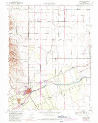
1953 Map of Winters
USGS Topo · Published 1990About this map
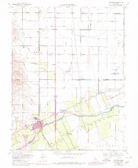
Winters serves as the focal point for this survey of the northern Sacramento Valley border, where the valley floor meets the base of the Coast Range. The town's grid is bisected by the Southern Pacific railroad line, which historically linked the agricultural producers of the region to wider markets. Water management is a dominant theme of the landscape, evidenced by the channel of Putah Creek and the numerous irrigation features including Chickahominy Slough and Dry Slough.
Find a feature on this map
27 named features on this map. Tap any name to fly to it.
Don’t see what you’re looking for? This feature index may not catch every label — zoom into the map to look around manually.
Map Details
Editions of this 1953 Winters Map
6 editions found
Other maps of this area

1902 · Napa
USGS Topo · 1:125,000

1905 · Esparto
USGS Topo · 1:24,000

1907 · Woodland
USGS Topo · 1:62,500

1908 · Vacaville
USGS Topo · 1:62,500

1915 · Yolo
USGS Topo · 1:31,680

1915 · Merritt
USGS Topo · 1:31,680

1916 · Dixon
USGS Topo · 1:31,680

1916 · Jacobs Corner
USGS Topo · 1:31,680

1916 · Winters
USGS Topo · 1:31,680

1916 · Esparto
USGS Topo · 1:31,680