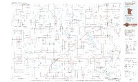
1985 Map of Worthington
USGS Topo · Published 1985About this map
Worthington serves as the primary hub in this mid-1980s look at the agricultural heart of Southwest Minnesota and Northwest Iowa. The landscape is defined by a dense grid of section lines and the tracks of the Chicago and North Western railroad, which links together small elevator towns like Brewster, Reading, and Rushmore. To the north and east, the drainage of the Des Moines River and Watonwan River feeds into numerous natural basins and conservation areas, including Talcot Lake and Kilen Woods State Park.
Find a feature on this map
117 named features on this map. Tap any name to fly to it.
Don’t see what you’re looking for? This feature index may not catch every label — zoom into the map to look around manually.
Map Details
Editions of this 1985 Worthington Map
2 editions found
Other maps of this area

1953 · Watertown
USGS Topo · 1:250,000

1953 · New Ulm
USGS Topo · 1:250,000

1954 · Fairmont
USGS Topo · 1:250,000

1955 · Sioux Falls
USGS Topo · 1:250,000

1957 · New Ulm
USGS Topo · 1:250,000

1958 · New Ulm
USGS Topo · 1:250,000

1958 · Sioux Falls
USGS Topo · 1:250,000

1958 · Fairmont
USGS Topo · 1:250,000

1958 · Watertown
USGS Topo · 1:250,000

1960 · Brewster
USGS Topo · 1:24,000