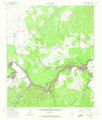
1962 Map of Wyser Bottom
USGS Topo · Published 1974About this map
Wyser Bottom and the sweeping bends of the Trinity River define this riverine landscape at the border of Walker and Houston counties. The southwestern portion of the map is dominated by the Eastham State Prison Farm, which is accessed by the Prison Farm Road and includes specialized features like a water tank and a borrow pit. The alluvial plains and bluffs are dotted with small family and community sites, including the Spivey Cem, Dunlap Cem, and New Hope Ch, reflecting the rural settlement patterns of the early 1960s. Along the river's winding course, numerous oxbows and floodplain lakes such as Horseshoe Lake, Big Tucker Lake, and Moten Lake mark the historical migration of the channel. Further south, the dense woodland of the bottomlands is punctuated by Lost Indian Camp near the banks of Indian Hill Lake.
Find a feature on this map
37 named features on this map. Tap any name to fly to it.
Don’t see what you’re looking for? This feature index may not catch every label — zoom into the map to look around manually.
Map Details
Editions of this 1962 Wyser Bottom Map
2 editions found
Other maps of this area

1953 · Palestine
USGS Topo · 1:250,000

1954 · Beaumont
USGS Topo · 1:250,000

1957 · Beaumont
USGS Topo · 1:250,000

1957 · Palestine
USGS Topo · 1:250,000

1960 · Trinity West
USGS Topo · 1:24,000

1961 · Riverside
USGS Topo · 1:24,000

1962 · Pine Prairie
USGS Topo · 1:24,000

1962 · Lovelady South
USGS Topo · 1:24,000

1962 · Wyser Bottom
USGS Topo · 1:24,000

1962 · Baker Lake
USGS Topo · 1:24,000