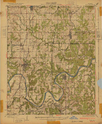
1932 Map of Yale
USGS Topo · Published 1932About this map
The Cimarron River carves a winding path through this central Oklahoma landscape, where the early 1930s oil economy and agrarian roots intersect. The map documents a dense network of country schools, including Primrose Sch No 1 and Eagle Sch, indicating a well-populated rural district at the time of the survey. The industrial influence is clearly visible near Oilton with an concentration of Oil Tanks and rail connections, reflecting the importance of petroleum during this era.
Find a feature on this map
52 named features on this map. Tap any name to fly to it.
Don’t see what you’re looking for? This feature index may not catch every label — zoom into the map to look around manually.
Map Details
Editions of this 1932 Yale Map
3 editions found

Other maps of this area

1901 · Nuyaka
USGS Topo · 1:125,000

1908 · Agra
USGS Topo · 1:62,500

1912 · Hominy
USGS Topo · 1:125,000

1915 · Hominy
USGS Topo · 1:125,000

1915 · Hominy
USGS Topo · 1:62,500

1916 · Bristow
USGS Topo · 1:62,500

1929 · Yale
USGS Topo · 1:62,500

1929 · Ripley
USGS Topo · 1:62,500

1929 · Skedee
USGS Topo · 1:62,500

1930 · Pawnee
USGS Topo · 1:62,500