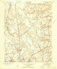
1951 Map of Yellow Tavern
USGS Topo · Published 1951About this map
The Jeb Stuart Monument serves as a focal point near Yellow Tavern in this mid-century survey of the Virginia interior. The landscape is defined by the winding course of the Chickahominy River and the convergence of critical transportation arteries, including the Richmond Fredericksburg and Potomac and the Chesapeake and Ohio railroads. Small rural hubs like Goddin Store, Heaths Store, and Jenkins Store are scattered across the terrain, indicating a network of local commerce that sustained the surrounding farms and homesteads.
Find a feature on this map
62 named features on this map. Tap any name to fly to it.
Don’t see what you’re looking for? This feature index may not catch every label — zoom into the map to look around manually.
Map Details
Editions of this 1951 Yellow Tavern Map
This is the sole edition of this map. No revisions or reprints were ever made.
Other maps of this area

1890 · Goochland
USGS Topo · 1:125,000

1892 · Goochland
USGS Topo · 1:125,000

1894 · Richmond
USGS Topo · 1:62,500

1895 · Richmond
USGS Topo · 1:62,500

1918 · Doswell
USGS Topo · 1:62,500

1934 · Seven Pines
USGS Topo · 1:24,000

1934 · Richmond
USGS Topo · 1:24,000

1936 · Richmond West
USGS Topo · 1:24,000

1936 · Glen Allen
USGS Topo · 1:24,000

1938 · Seven Pines
USGS Topo · 1:31,680