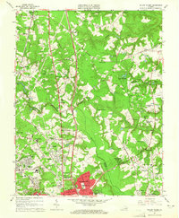
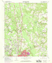
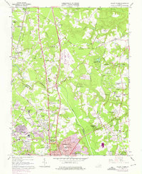
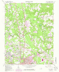
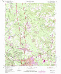
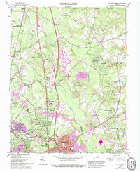
1963 Map of Yellow Tavern
USGS Topo · Published 1965About this map
The Henry Clay Birthplace and the JEB Stuart Monument anchor this 1963 survey of the Hanover and Henrico county borderlands, a landscape deeply connected to Virginia's political and military history. Settlement patterns follow the historic Telegraph Road and the Richmond Fredericksburg And Potomac Railroad, where small communities like Ashland, Gwathmey, and Elmont thrive alongside local commerce at Heaths Store and Solomons Store.
Find a feature on this map
110 named features on this map. Tap any name to fly to it.
Don’t see what you’re looking for? This feature index may not catch every label — zoom into the map to look around manually.
Map Details
Editions of this 1963 Yellow Tavern Map
6 editions found
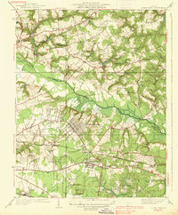
Other maps of this area

1890 · Goochland
USGS Topo · 1:125,000

1892 · Goochland
USGS Topo · 1:125,000

1894 · Richmond
USGS Topo · 1:62,500

1895 · Richmond
USGS Topo · 1:62,500

1918 · Doswell
USGS Topo · 1:62,500

1934 · Seven Pines
USGS Topo · 1:24,000

1934 · Richmond
USGS Topo · 1:24,000

1936 · Richmond West
USGS Topo · 1:24,000

1936 · Glen Allen
USGS Topo · 1:24,000
1938 · Seven Pines
USGS Topo · 1:31,680