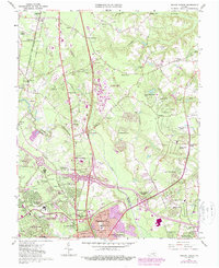
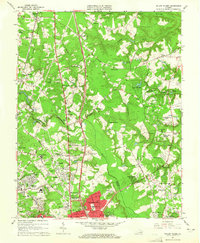
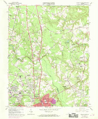
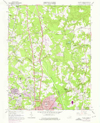
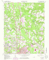
1963 Map of Yellow Tavern
USGS Topo · Published 1987About this map
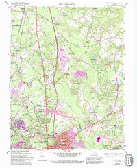
Yellow Tavern and the historic Henry Clay Birthplace anchor this 1963 survey of the Virginia landscape where the Hanover Co and Henrico Co borders meet. The map reveals a transition from traditional rural crossroad communities like Heaths Store, Pearsons Corner, and Borkeys Store to the burgeoning suburban developments of Chamberlayne Farms and Laurel Park. Significant historical markers, such as the JEB Stuart Monument, stand alongside early transit corridors including the Richmond Fredericksburg and Potomac Railroad and an Old Railroad Grade. The terrain is defined by the winding course of the Chickahominy River and the high ground of Goddin Hill. Local social life is evidenced by institutions like St Josephs Villa, the Spring Lake Country Club, and venerable houses of worship including Slash Ch and Lebanon Ch. The 1987 photorevision updates show the expanding footprint of the Hanover County Municipal Airport and the complex modern highway interchanges.
Find a feature on this map
85 named features on this map. Tap any name to fly to it.
Don’t see what you’re looking for? This feature index may not catch every label — zoom into the map to look around manually.
Map Details
Editions of this 1963 Yellow Tavern Map
6 editions found
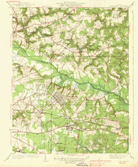
Other maps of this area

1890 · Goochland
USGS Topo · 1:125,000

1892 · Goochland
USGS Topo · 1:125,000

1894 · Richmond
USGS Topo · 1:62,500

1895 · Richmond
USGS Topo · 1:62,500

1918 · Doswell
USGS Topo · 1:62,500

1934 · Seven Pines
USGS Topo · 1:24,000

1934 · Richmond
USGS Topo · 1:24,000

1936 · Richmond West
USGS Topo · 1:24,000

1936 · Glen Allen
USGS Topo · 1:24,000
1938 · Seven Pines
USGS Topo · 1:31,680