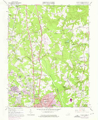
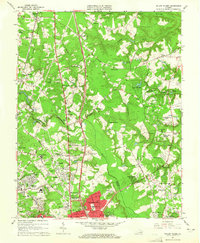
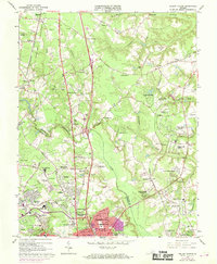
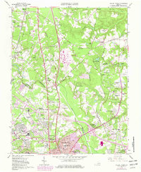
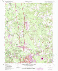
1963 Map of Yellow Tavern
USGS Topo · Published 1975About this map
The Chickahominy River winds through this landscape just north of Richmond during a period of significant suburban expansion in the early 1960s. The map captures the historic crossroads of Yellow Tavern, the site of a pivotal Civil War engagement, marked here by the JEB Stuart Monument. While new residential developments like Holly Glen Estates and Chamberlayne Heights begin to fill the southern half of the sheet, the northern reaches maintain a more rural character defined by old country roads and community hubs. Transport corridors are central to the area's identity, with the Richmond Fredericksburg and Potomac Railroad and the Chesapeake and Ohio railway lines cutting through the terrain. Traditional landmarks such as Slash Ch, Solomons Store, and Heaths Store persist alongside newer infrastructure, including the Hermitage-Ethelwood Country Club and several small airfields.
Find a feature on this map
105 named features on this map. Tap any name to fly to it.
Don’t see what you’re looking for? This feature index may not catch every label — zoom into the map to look around manually.
Map Details
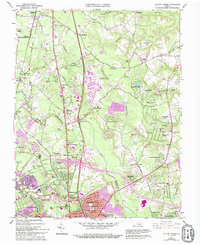
Editions of this 1963 Yellow Tavern Map
6 editions found
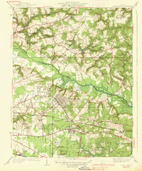
Other maps of this area

1890 · Goochland
USGS Topo · 1:125,000

1892 · Goochland
USGS Topo · 1:125,000

1894 · Richmond
USGS Topo · 1:62,500

1895 · Richmond
USGS Topo · 1:62,500

1918 · Doswell
USGS Topo · 1:62,500

1934 · Seven Pines
USGS Topo · 1:24,000

1934 · Richmond
USGS Topo · 1:24,000

1936 · Richmond West
USGS Topo · 1:24,000

1936 · Glen Allen
USGS Topo · 1:24,000
1938 · Seven Pines
USGS Topo · 1:31,680