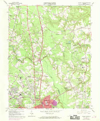
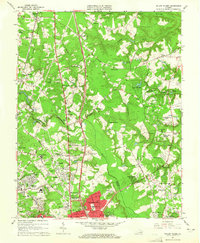
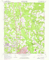
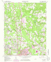
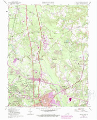
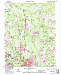
1963 Map of Yellow Tavern
USGS Topo · Published 1969About this map
Henry Clay Birthplace and the JEB Stuart Monument anchor this historical study of the landscape north of Richmond during a period of suburban expansion. The 1960s terrain is defined by the prominent dual corridors of the Richmond Fredericksburg and Potomac Railroad and the Chesapeake and Ohio Railroad, which cut through established communities like Ashland, Gwathmey, and Yellow Tavern. Local life is recorded through numerous small churches and rural schoolhouses, including Slash Ch, Mt Hermon Ch, and the Elmont Sch. While the southern portion of the map near Chamberlayne Heights shows increasing residential development, the northern reaches maintain a character of creek-side farms and gravel pits along Mechumps Creek and the Chickahominy River.
Find a feature on this map
103 named features on this map. Tap any name to fly to it.
Don’t see what you’re looking for? This feature index may not catch every label — zoom into the map to look around manually.
Map Details
Editions of this 1963 Yellow Tavern Map
6 editions found
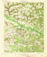
Other maps of this area

1890 · Goochland
USGS Topo · 1:125,000

1892 · Goochland
USGS Topo · 1:125,000

1894 · Richmond
USGS Topo · 1:62,500

1895 · Richmond
USGS Topo · 1:62,500

1918 · Doswell
USGS Topo · 1:62,500

1934 · Seven Pines
USGS Topo · 1:24,000

1934 · Richmond
USGS Topo · 1:24,000

1936 · Richmond West
USGS Topo · 1:24,000

1936 · Glen Allen
USGS Topo · 1:24,000
1938 · Seven Pines
USGS Topo · 1:31,680