1940s Maps of Arizona
Explore 187 historic maps of Arizona from the 1940s. These maps offer a rare glimpse into what life looked like during the 1940s — showing old roads, neighborhoods, homes, and landmarks that have changed or disappeared over time.
Whether you're researching your family's past, planning a metal detecting trip, or studying how Arizona's landscape evolved across the 1940s, these high-resolution maps are a powerful tool for exploring the history of this region.
- Focus on a specific era: All maps on this page are from the 1940s, giving you a focused view of this time period.
- See what’s changed: Compare century-old streets, trails, and buildings to today's modern landscape using overlays and satellite layers.
- Research with precision: Use these maps for genealogy, historical research, land use analysis, or educational projects.
- View, download, or print: Maps are fully viewable online in high resolution, and can be downloaded or printed for your own records.
Start exploring Arizona's history through authentic maps from the 1940s. This is your window into the past.
Arizona maps
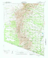
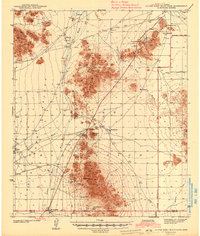
(187)- 1940 Map of Jacob Lake
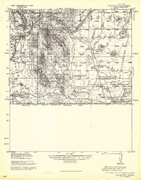
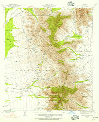
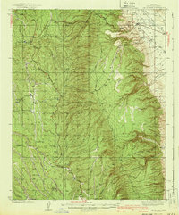 1940 Jacob Lake1940 Print · USGSThe high plateau of the Arizona Strip is captured here in the mid-1930s, showing the early forest service and ranching footprint. You can trace the historic Kane Trail, locate the Jacob Lake Ranger Sta, and identify remote watering spots like Kane Springs.2 unique versions available
 - 1940 Map of Apache
 1940 Apache1940 Print · USGSArizona and New Mexico ranching culture is captured here during the early twentieth century, showing the rugged borderlands before modern development. Genealogists can trace family homesteads like Darnell Ranch and find rural landmarks like Texizona School and Moores Spur.
 - 1940 Map of Pine
 1940 Pine1940 Print · USGSThe northern Arizona highlands are captured here in the mid-1930s, showing the rugged divide of the Mogollon Rim. Local historians can trace early settlements at Pine and Strawberry, along with remote sites like Chase Ranch and the White Mtn Mine.
 - 1940 Map of Dome Rock Mts
 1940 Dome Rock Mts1940 Print · USGSThe Arizona and California borderlands along the Colorado River are captured here during the 1930s mining era. Researchers can trace historic prospecting sites like the Darling Mine and Goodman Mine or locate crossings at Diablo Pass.3 unique versions available
 - 1940 Map of Elgin
 1940 Elgin1940 Print · USGSSoutheastern Arizona ranching country is shown here just before the mid-century, where the Southern Pacific railroad connects remote desert outposts. Researchers can locate early family homesteads like Gardner's Ranch and Rodgers Ranch alongside the historic site of Old Ft. Crittenden.
 - 1940 Map of College Peaks
 1940 College Peaks1940 Print · USGSThe Arizona-Mexico border comes alive in this pre-war survey of the high desert and cattle country. Genealogists and historians can trace the vast San Bernardino Grant and family outposts like Slaughters Ranch San Bernardino or the Ed Howard Ranch.
 - 1940 Map of Yuma, 1956 Print
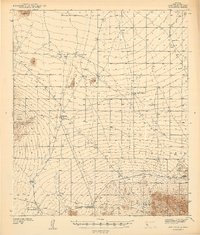
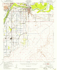 1940 Yuma1956 Print · USGSYuma and the surrounding desert irrigation districts are captured here at the start of the 1940s as the river economy matured. Genealogists and local historians can trace the foundations of Somerton, the Indian Sch, and family-named schools like Crane Sch.3 unique versions available
 - 1940 Map of Palo Alto Ranch, 1956 Print
 1940 Palo Alto Ranch1956 Print · USGSThe Pima County desert landscape in the 1940s is shown here as a network of cattle outposts and dormant mineral claims. Genealogists and historians can locate family holdings like Anvil Ranch and trace the history of mining at the Banner Mine or Aguinaldo Mine.3 unique versions available
 - 1940 Map of Sierra Bonita Ranch, 1960 Print
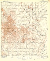
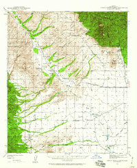 1940 Sierra Bonita Ranch1960 Print · USGSGraham County ranching and rugged canyon lands are captured here just before the 1940s, showing a landscape of remote outposts and high-desert water sources. Researchers can trace the heritage of the Sierra Bonita Ranch, locate the Sunset School, or find vanished sites like the Shotgun Smith Ranch (Abandoned).2 unique versions available
 - 1941 Map of Presumido Peak
 1941 Presumido Peak1941 Print · USGSThe Arizona borderlands in the early 1940s are defined here by cattle ranching and tribal lands along the international line. Researchers can trace historic properties like Rancho de la Osa and Buenos Aires Ranch or locate the Site of Old Indian Fort near Sasabe.2 unique versions available
 - 1941 Map of Twin Buttes
 1941 Twin Buttes1941 Print · USGSSouthern Arizona ranching and mining culture is well-documented in this late-1930s survey of the Sierrita foothills. Researchers can locate the McGee Sch, the rails of the Southern Pacific RR, and family-named landmarks like Canoa Ranch and Harris Ranch.
 - 1941 Map of Vekol Mountains
 1941 Vekol Mountains1941 Print · USGSMining activity and tribal settlements characterize this desert region in the late 1930s. Genealogists and historians can trace indigenous communities at Sif Vaya and Kohatk alongside early mineral prospects like the Vekol Mine and Reward Mine.
 - 1941 Map of San Vicente
 1941 San Vicente1941 Print · USGSPima County ranching and tribal lands are captured in the late 1930s before modern development altered this desert landscape. Genealogists and historians can trace family-named sites like San Ignacio Ranch and settlements including San Vicente and Haivana Nakya.
 - 1941 Map of Cocoraque Butte, 1942 Print
 1941 Cocoraque Butte1942 Print · USGSPima County ranching and reservation life are captured here in the early 1940s, just as the local road network began to stabilize. Researchers can trace historic property boundaries and desert outposts like Cocoraque Ranch, Robles Junction, and the indigenous settlement of Viopuli.2 unique versions available
 - 1941 Map of Baboquivari Peak, 1955 Print
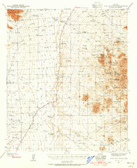
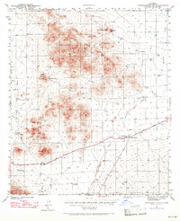
 1941 Baboquivari Peak1955 Print · USGSArizona's Tohono O'odham lands come alive in this wartime survey, showing the deep connection between ranching families and the desert landscape. Genealogists and historians can trace the locations of the Allison Mine, Fresnal Canyon School, and numerous holdings like Otero Ranch.3 unique versions available
 - 1941 Map of Arivaca, 1956 Print
 1941 Arivaca1956 Print · USGSIn the early 1940s, this southern Arizona cattle and mining district centered around Arivaca and its surrounding family ranches. Trace the legacy of desert prospecting at the Las Guijas Mine or locate historic homesteads like Canoa Ranch and Montana Ranch.2 unique versions available
 - 1941 Map of Vamori, 1958 Print
 1941 Vamori1958 Print · USGSTraditional O'odham life in the early 1940s is mapped here across the desert expanses of the Papago Indian Reservation. Genealogists and historians can locate remote settlements and family landmarks including San Miguel, Ak Chut Vaya, and San Agustin Ranch.3 unique versions available
 - 1941 Map of Sells, 1969 Print
 1941 Sells1969 Print · USGSThe Papago Indian Reservation in the early 1940s reveals a desert landscape of ancestral villages and active mining. Trace family roots and desert trails through Sells, Topawa, and the historic San Solano Mission.
 - 1942 Map of Camp Mohave
 1942 Camp Mohave1942 Print · USGSThe tri-state borderlands of Nevada, Arizona, and California are captured here in the early 1940s, highlighting a landscape of deep canyons and high-desert mining camps. Researchers can trace historic rail lines and find remote outposts like Searchlight, Nelson, and the riverfront Fort Mohave Indian Reservation.
 - 1942 Map of Silver Reef Mountains
 1942 Silver Reef Mountains1942 Print · USGSPinal County's desert mining and indigenous heritage are recorded here in the early 1940s, just as these remote districts were being systematically surveyed. Genealogists and historians can trace the locations of traditional settlements like Vaiva Vo and Kohatk alongside numerous mining claims including the Silver Reef Mine and Jackrabbit Mine.2 unique versions available
 - 1942 Map of Sierra Bonita Ranch
 1942 Sierra Bonita Ranch1942 Print · USGSGraham County cattle country comes to life in the early 1940s, showing a vast ranching landscape defined by remote outposts and scarce water. Trace the locations of historic headquarters like Sierra Bonita Ranch and Eureka Ranch, or find the lonely Sunset School and Whalum Cem.
 - 1942 Map of Vekol Mountains
 1942 Vekol Mountains1942 Print · USGSThe high desert of southern Arizona comes into focus during the late 1930s as a hub for mineral exploration and tribal settlement. Miners and genealogists can trace the locations of the Vekol Mine, Copperosity Mine, and the settlement of Sif Vaya.
 - 1942 Map of Ruby
 1942 Ruby1942 Print · USGSThe Arizona-Mexico borderlands during the early 1940s reveal a landscape of remote mining claims and family-run cattle operations. Trace the history of the Dos Amigos Mine, the Pena Blanca CCC CAMP, and the settlement of Ruby amidst the high desert peaks.3 unique versions available
 - 1942 Map of Yuma
 1942 Yuma1942 Print · USGSThe desert frontier near Yuma underwent a massive transformation during the early war years as irrigation and military infrastructure expanded. Researchers can trace the development of the All American Canal Project and locate numerous historic workings like the Fortuna Mine and Old Senator Mine.
 - 1942 Map of San Vicente
 1942 San Vicente1942 Print · USGSThe Sonoran desert landscape of Pima County is captured here in the late 1930s, showing the early ranching and mining infrastructure of the Papago Indian Reservation. Genealogists and historians can locate remote outposts like San Ignacio Ranch, Wattle Hut, and the Roadside Mine.
Showing maps 1-25 of 187
Top cities of Arizona
- Phoenix historical maps
- Tucson historical maps
- Mesa historical maps
- Chandler historical maps
- Glendale historical maps
- Scottsdale historical maps
See more
Top counties of Arizona
- Maricopa County historical maps
- Pima County historical maps
- Pinal County historical maps
- Yavapai County historical maps
- Mohave County historical maps
- Coconino County historical maps
See more
Frequently asked questions
- What are the different types of historical maps available for Arizona?
- What is the oldest map of Arizona?
- Where can I purchase historical maps of Arizona for my home or office?
- Where can I download high-res historical maps of Arizona?
- Are there historical topographic maps available for Arizona?
- Is there historical aerial imagery available for Arizona?
- Where are historical maps of Arizona sourced from?